Linear and Area Measurements from Real-Word Objects, Locations or Places
Linear & Area Measurements?
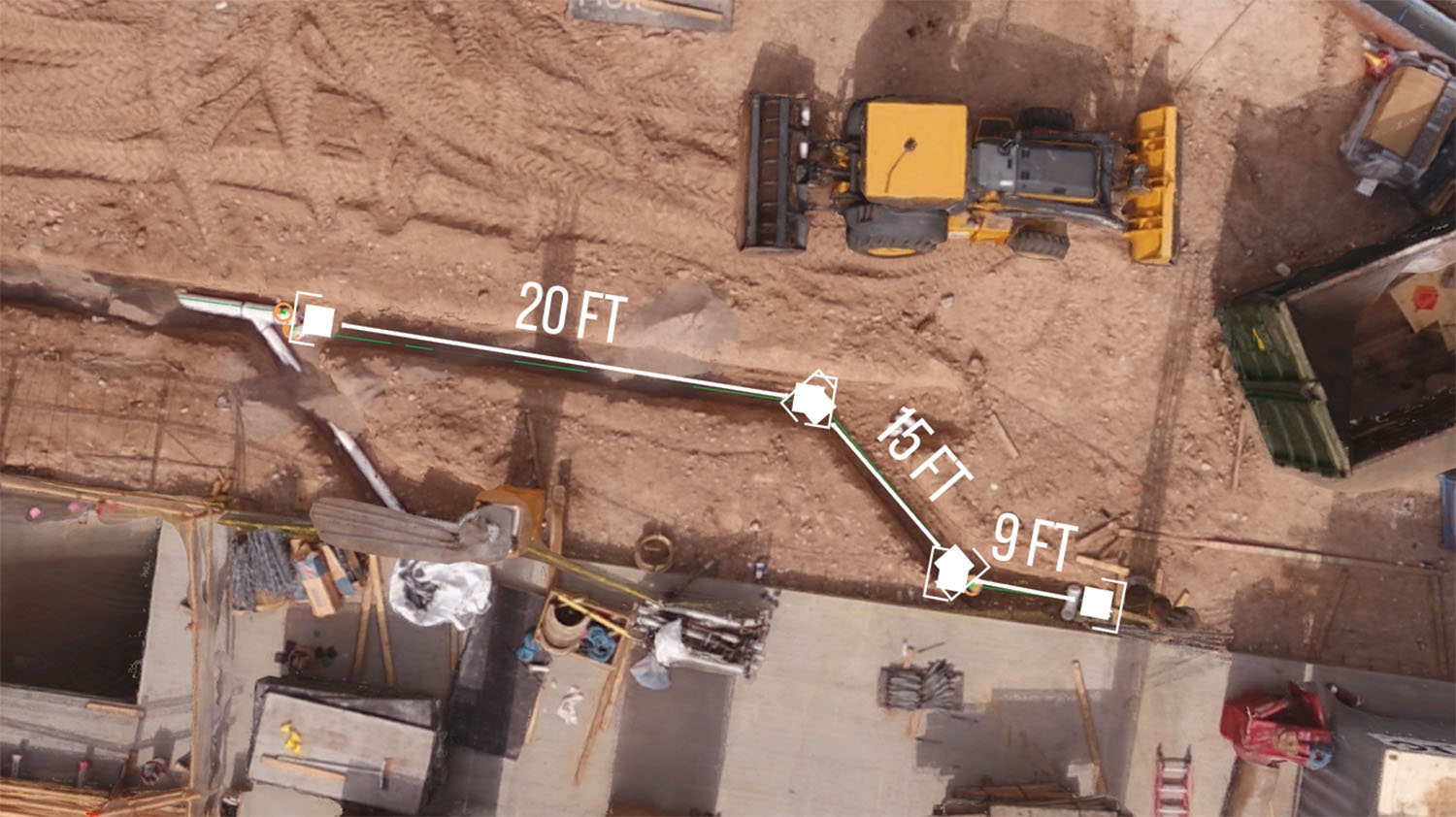
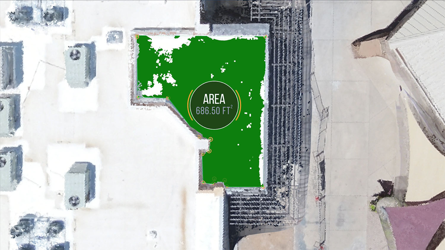
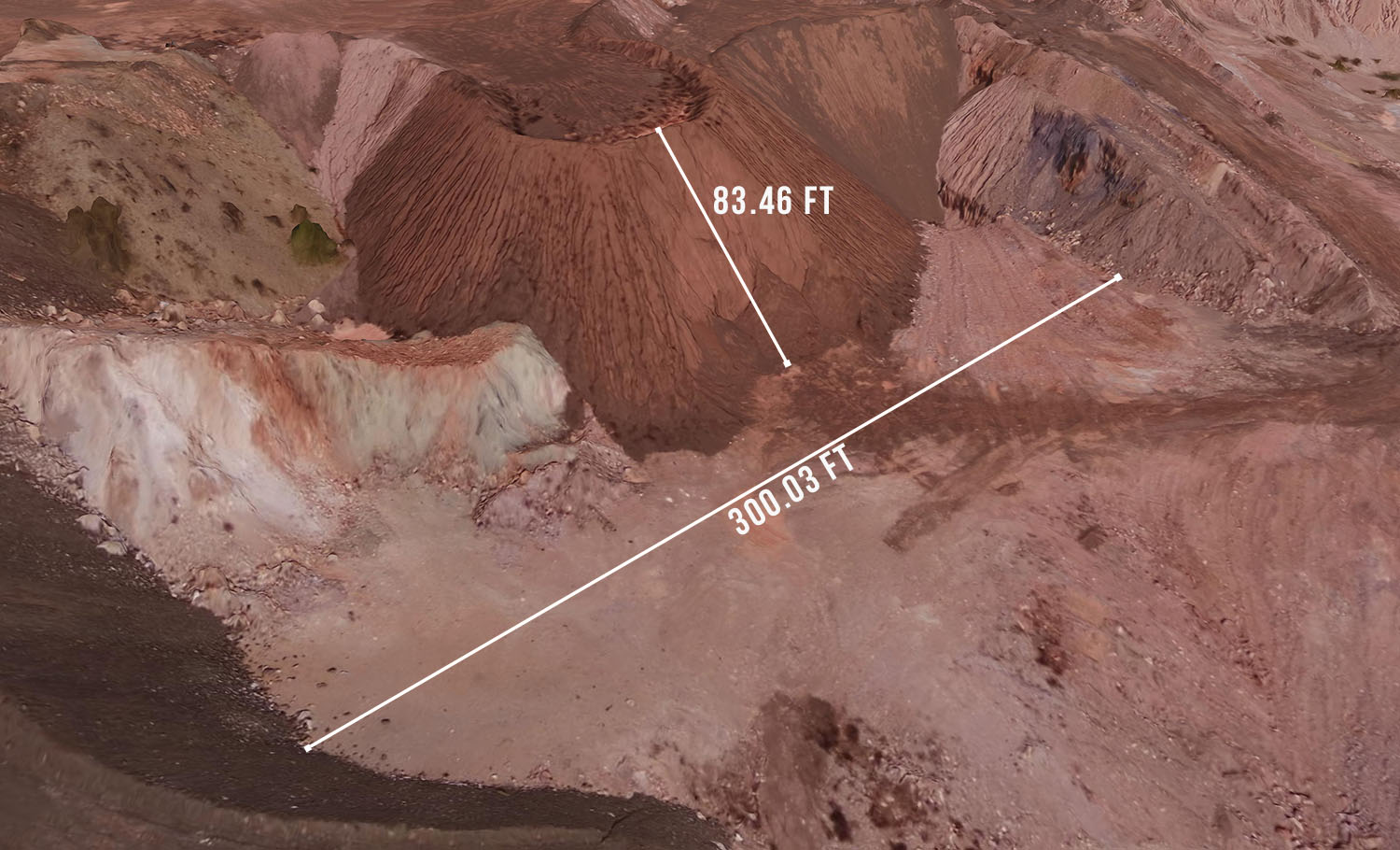
We generate a point cloud of your real-world object, location, or jobsite so we can to take accurate linear and area measurements.
Sula Aerials provides a easy to read, detailed pdf report of your project based your project data needs. We can generate distances, area, volume measurements and more!
Want to produce your own measurements from the 3D point cloud we generate? Here are the file types we deliver in:
- .xyz – Used in AutoCAD software for visualization
- .ply – Used for visualization and point cloud classification
- .las – Used for visualization and point cloud classification
- .laz – Great for visualization
Commercial Building Roof Area Measurements
Open-Pit Mine Linear Measurements
Sula Aerials can only provide survey-grade land data with the cooperation of a licensed surveyor. Sula Aerials is not licensed to provide independent survey data.